Progressive Hypsometry and the glacial limitation of tropical mountain ranges
Study sites
Revealing glacial limitation of tropical mountain ranges
Seeking to broadly assess the potential for glacial limitation in tropical mountain ranges, we reviewed all those ranges close to the height of the cpELA. Within this broad selection, we sought a subset uncontaminated by processes that would distort or complicate any signal of glacial limitation. In particular, we wanted to avoid any confusion between the passive uplift of low-relief terrain from that of in-situ glacial erosion. The potential for such confusion is strongest in the Peruvian/Bolivian Andes, the Sierra Madre of Mexico and Guatemala, the central highlands of Papua New Guinea, all of which are characterized by large, internally drained plateaus disconnected from external base-level; as such, these regions were excluded from our analysis. Volcanism is another complicating factor, in that glaciated volcanoes have undergone a mix of construction and erosion that cannot easily be disentangled. Therefore, glaciated volcanoes such as those in East Africa (Mt. Kilimanjaro and Mt. Kenya) and Papua New Guinea (Mt. Giluwe) were excluded from our analysis. A final constraint was that each range must be circumferentially well-connected to external base-level (sea-level or lake-level) by relatively short fluvial links.
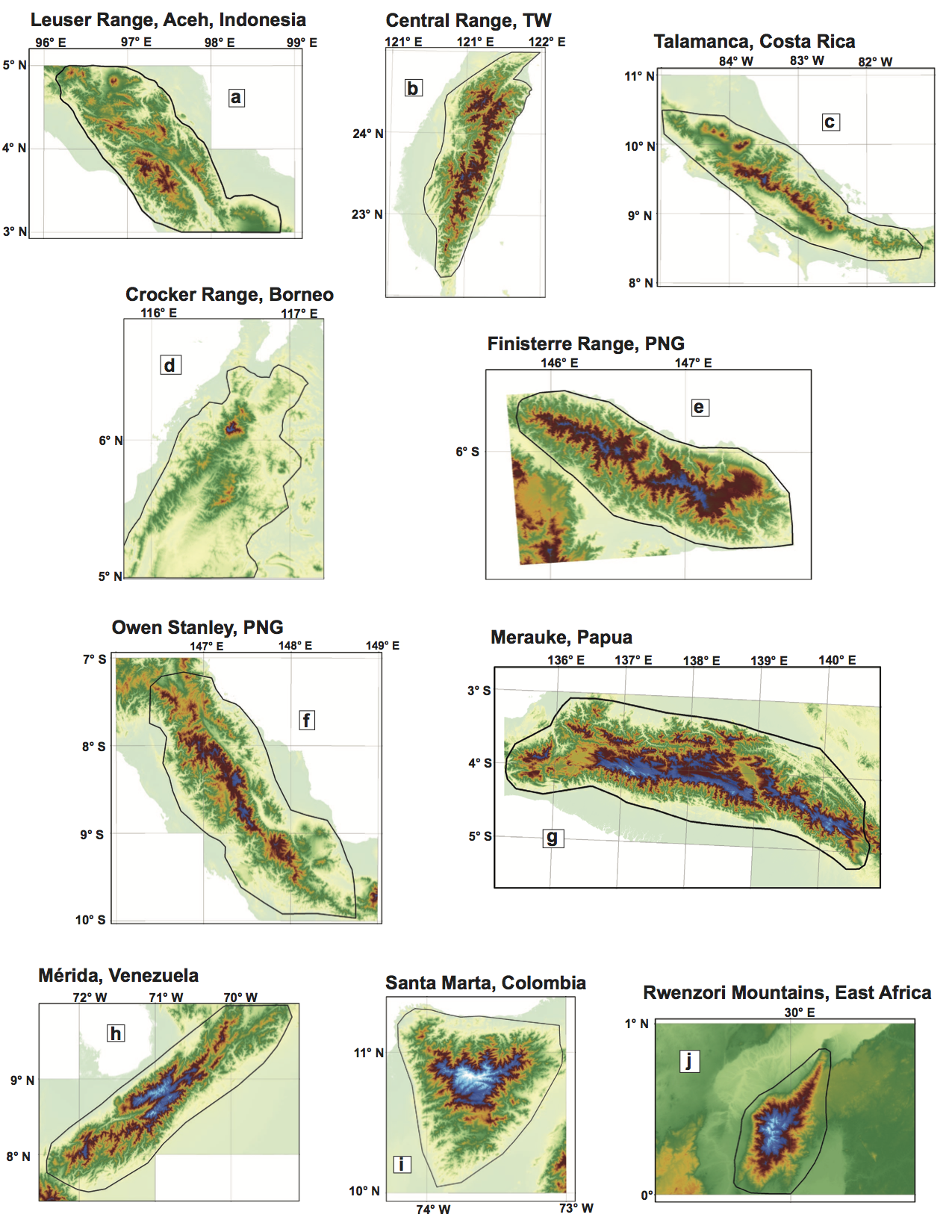
The following ten tropical mountain ranges remain and were selected for analysis:
- Leuser Range, Aceh, Indonesia
- Central Range, Taiwan
- Talamanca Range, Costa Rica
- Crocker Range, Borneo
- Finisterre Range, Papua New Guinea
- Owen Stanley Range, Papua New Guinea
- Merauke Range, Papua
- Mérida Range, Venezuela
- Sierra Nevada de Santa Marta, Colombia
- Rwenzori, East Africa

SRTM DEMs of selected tropical mountain belts. Yellow-green through red spans elevations 0-3400 m. Dark blue to light blue is 3400-4500 m (tropical cpELA to wpELA). Black polygons circumscribing each range indicate bounds for hypsometric analysis.