Progressive Hypsometry and the glacial limitation of tropical mountain ranges
Data
Digital elevation models used to assess glacial limitation
All topographic analysis was performed on 1-arcsecond (projected at 30 m resolution) Shuttle Radar Topography Mission (SRTM) digital topography (Farr et al., 2007). SRTM data were acquired using U.S. Geological Survey Earth Explorer.
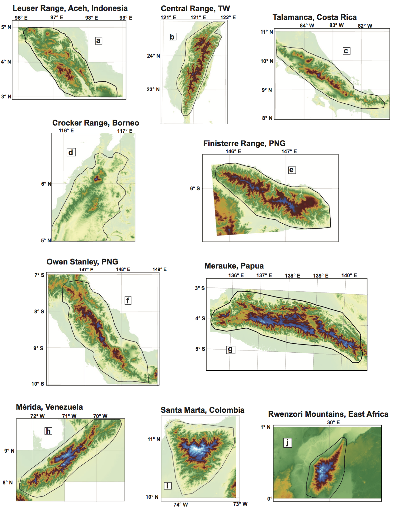
SRTM DEMs of selected tropical mountain belts. Yellow-green through red spans elevations 0-3400 m. Dark blue to light blue is 3400-4500 m (tropical cpELA to wpELA). Black polygons circumscribing each range indicate bounds for hypsometric analysis